1.3.1: town notes and numbered hexes
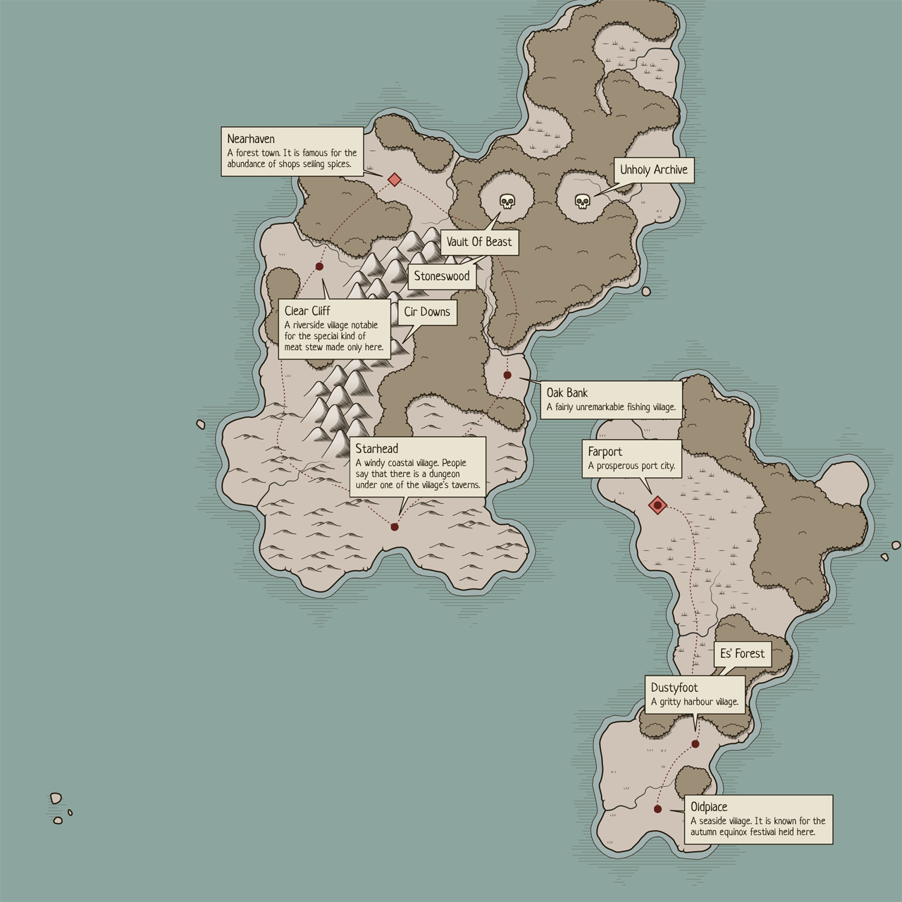 Perilous Shores has been updated. Most of today's changes are settlement-related apart from the numbered hexes...(more)
Perilous Shores has been updated. Most of today's changes are settlement-related apart from the numbered hexes...(more)
Fantasy region generator
| Status | In development |
| Category | Tool |
| Author | watabou |
| Genre | Role Playing |
| Tags | Fantasy, Generator, Procedural Generation |
| Languages | English |
| Accessibility | Color-blind friendly, High-contrast |
Comments
Log in with itch.io to leave a comment.
This is becoming more and more fantastic. Super excited to see where it goes :)
Thanks for the update, especially the numbers for hexes! I found purple seems to be a good color for them to stand out.
I just realized i had to click on towns to get the description to pop up. Also some non-POI hexes have descriptions too. Nice. Would it be possible when exporting to have a tickbox to show descriptions in the exported image?
Do you plan on having coastal towns and harbors generated? these could have a small dock or Anchor icon right on the coastline. I could see people could use multiple maps within the same world as it were in a campaign and departing from harbor/map and arrive at another, on a different map. There could be an option of how many or none.
Is there any plans for options for larger map size, like doing a large continent?
You can click any feature on the map (i.e. village, town, settlement, danger, mountain, swamp, desert, forest) to see its name on a "sticker", but currently only settlements have real descriptions. It is possible to display more than one sticker by "shift-clicking" features (vs regular clicking) - this works in the same way as file selection in File Explorer or Finder. Also you can "ctrl+click" any feature to display stickers for all the features of the almanac. All the stickers get exported along with the rest of the map both in PNG and SVG.
I'm not sure I get your questions about coastal towns. Any settlement on a hex which borders the water is considered a coastal settlement: click it and you'll see "A seaside town known for..." or something like that. On the settlement map (in MFCG and VG) there will a coast and probably some piers.
I am planning to implement maps of arbitrary size in the future (with some reasonable limitations in place), although for me personally the main reason to do it is to be able to generate non-square maps. I tried to build larger maps (i.e. consisting of a large numbers of hexes) and it doesn't look very good - mountain ranges, rivers and some other features look wrong.
Thanks for your reply. Ctrl+click nice and simple method for displaying all descriptions at once. You could add that to the hotkey-list.
On the app itself top-left there could be a small font saying Press F1 to see hotkeys- which would appear in a free window or on the leftside of the app screen. Pressing F1 again to hide it. Perhaps exporting the map wont show them, even if currently displayed.
When you said non-square maps do you mean like rectangle maps instead for larger maps?
I had another thought too for larger maps, a Fog of War tool that can be toggled on/off. Which could be round or square frame over the map and the User could make it bigger or smaller via hotkey + mouse wheel and anything outside of the FOW window/overlay is just blank hexes or just not displayed. A GM/DM could use this app on a tv (connected to pc) or laptop and display the world 4x4 or 6x6 hexes at a time giving the players a sense of exploring the map rather than seeing everything at once.
Perhaps clicking a hex will center the FOW over it.
Of course printing the map out and cutting out a square or circle on a sheet of cardboard would do at present.